Does Shimbiri have nautical charts?
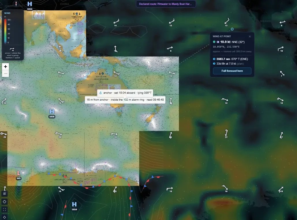
Yes. Shimbiri shows nautical charts for the whole Australian coast today, with depths, charted features and the weather drawn over them. Worldwide coverage is coming within weeks.
Every route is checked against the chart: shoals on the line are named with their depth at chart datum, and a destination on land is refused.
What it does
- Nautical charts for the whole Australian coast
- Depth at any point, and a depth profile along a route
- Charted shoals on your route, with the depth at chart datum
- A destination on land refused, with the reason
- Wind, pressure and weather fronts drawn over the chart
The chart below is Shimbiri’s own screen on 25 September 2026: the Australian coast charted, with the wind and the boat at anchor drawn over it.
Seen at sea
Off the NSW coast on 19 September 2026, asked how long to Sydney at 6 and at 10 knots, Shimbiri answered with the times and named a charted shoal on the line, 2.2 m at chart datum, with its position. Earlier, asked to plan a route into Pittwater, it refused a destination point that sat on charted high ground, 39 m above the water, and said why.
What you need
Charts work from a phone or PC. The boat’s own position on the chart comes from the Chief Engineer pack aboard.
Coming
- Worldwide chart coverage, due within weeks