Shimbiri
← All the apps

Which weather model should I trust for my passage?

The Weather Officer · Weather & passagesInstead of Windy.com· Current as of 26 September 2026

You do not have to pick one. Shimbiri reads several forecast models side by side, tells you where they agree and where they disagree, and names any model run that is out of date.

It then checks the forecast against your boat’s own instruments and the nearest weather station, so you can see when the models are reading low.

What it does

  • GFS, ECMWF, AIFS, ICON and UKMO compared side by side
  • A flag when the models disagree, and how widely
  • Each model run named, with the stale ones called out
  • Checked against your own instruments and the nearest weather station
  • Bureau of Meteorology warnings, rain radar and lightning
  • Wind measured at Bureau stations drawn on the chart, with the age of each reading
  • Wave height and swell direction
  • Ocean currents and tidal streams, on the same forecast clock as the wind
  • The Shimbiri blend: each model weighted by how closely it has matched the measured wind near you

Plan a passage on a real yacht in Brisbane and read the forecast from several models along the route. No account needed.

Try the forecast, free →

Seen at sea

Lady Barron, Flinders Island, 15 September 2026. When it went calm at anchor, Shimbiri put the boat’s instruments, the Flinders Island airport weather station 25 km away and five forecast models side by side, named the stale model run, and said the calm was a lull, not a trend. It blew up again that afternoon. The next day, mid Bass Strait, it caught the Bureau downgrading the gale warning within the hour and flagged the models reading low against the instruments.
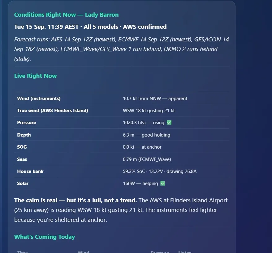
Shimbiri’s conditions answer at Lady Barron on 15 September 2026: five forecast models with their run times, the boat’s instruments beside the Flinders Island airport weather station
Screen recording, 19 September 2026: the live passage forecast, with the forecast model runs it read listed at the top.
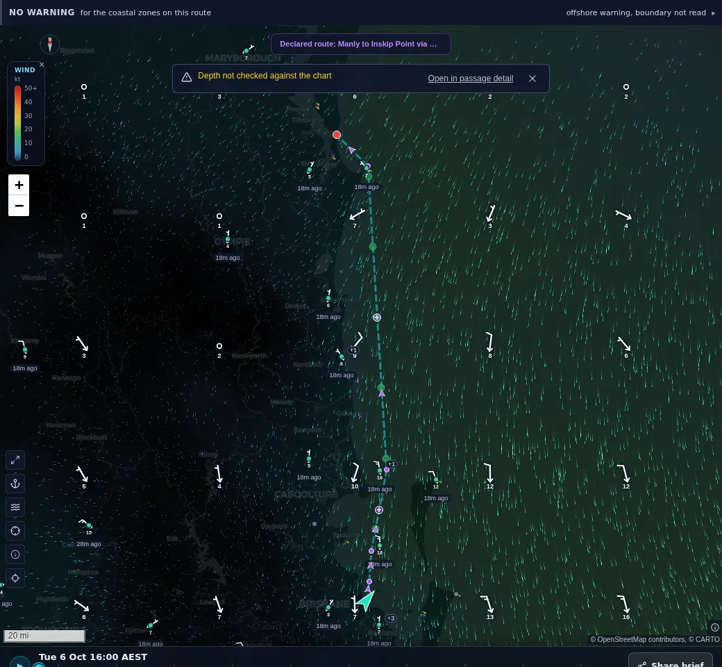
Shimbiri’s weather chart off south-east Queensland on 6 October 2026: forecast wind as moving particles, with wind barbs measured at Bureau stations, each marked with the age of its reading
Wind, 6 October 2026: the forecast as moving particles, and the wind measured at Bureau stations as barbs, each with how long ago it was read.
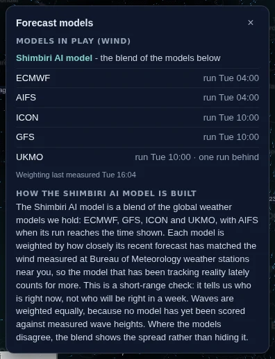
Shimbiri’s forecast models panel on 6 October 2026: ECMWF, AIFS, ICON, GFS and UKMO with their run times, and how the Shimbiri blend is weighted
The models behind the forecast, 6 October 2026: each run with its time, the stale one named, and how the Shimbiri blend weights each model by how closely it has matched the wind measured nearby.
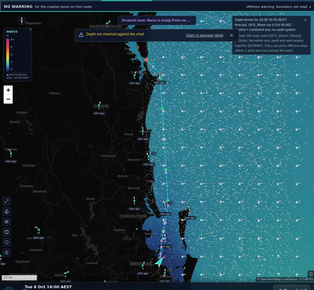
Shimbiri’s wave layer off south-east Queensland on 6 October 2026: combined sea height in colour with the main swell drawn as arrows, Moreton Bay sheltered
Waves, 6 October 2026: the height of the whole sea in colour and the main swell as arrows, with Moreton Bay sheltered behind the islands.
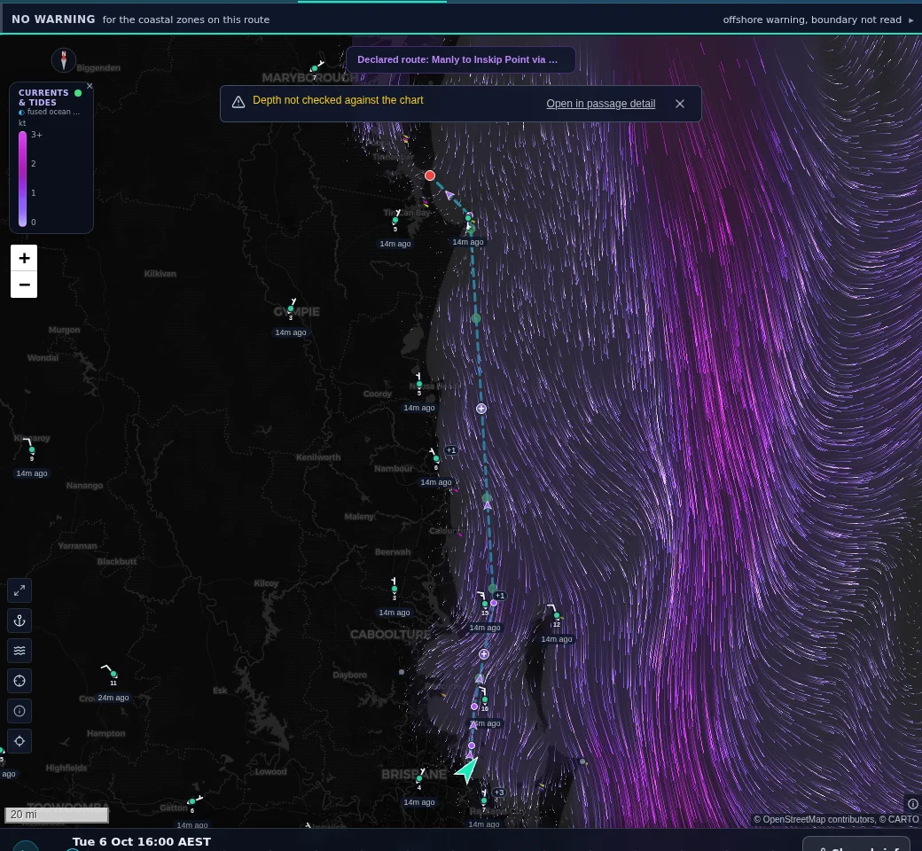
Shimbiri’s currents and tides layer on 6 October 2026: the East Australian Current running south off the Queensland coast, with tidal streams inside Moreton Bay
Currents and tides, 6 October 2026: the East Australian Current running south offshore, and the tidal streams inside Moreton Bay, on the same forecast clock as the wind.

What you need

Forecasts work from a phone or PC. Comparing them with your own instruments needs the Chief Engineer pack aboard.