What do I need to know about the water I’m in?
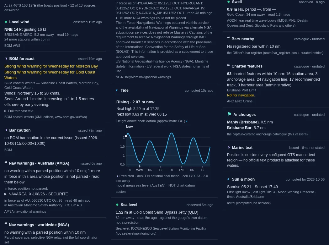
Open Local Knowledge and Shimbiri gathers what a local would tell you about the water around the boat, in one panel: the wind measured nearby, the Bureau forecast and any warnings, bar cautions, navigation warnings, the tide, the measured sea level, the swell and what is on the chart.
Every line says where it came from and how old it is, so you can see at a glance what is fresh and what is not.
What it does
- Wind measured at the nearest Bureau station, with the time it was read
- The Bureau coastal forecast, and any strong wind or gale warning for your waters
- Bar cautions, and Australian and worldwide navigation warnings near you
- The tide curve at your position, and the sea level measured at the nearest gauge
- Swell from the nearest wave buoy
- Bars, charted features and anchorages within 10 nm, with sunrise, sunset and the moon
The panel below is Shimbiri’s Local Knowledge at her berth in Manly, Moreton Bay, on 6 October 2026.
Seen at sea
Manly, Moreton Bay, 6 October 2026. At the berth, Local Knowledge answered from 12 of its 13 sources: north-north-east 14 knots gusting 16 at Brisbane airport, 5.2 km away; a strong wind warning for Wednesday on Moreton Bay and the Gold Coast; no bar caution; one Australian navigation warning in force; the tide rising at 2.07 m, with high water 2.20 m at 17:25; 1.52 m measured at the Gold Coast Sand Bypass Jetty gauge; 0.9 m of swell at the Gold Coast buoy; and Manly and Brisbane Bar as the nearest anchorages.
What you need
Works from a phone or PC. It reads at the boat’s own position, which comes from the Chief Engineer pack aboard.