How does the East Australian Current affect my passage?
The East Australian Current carries warm water south down the coast from the Coral Sea. CSIRO puts it at up to 30 million cubic metres a second, strongest in summer (peaking in February) and as little as half that in winter. It often crosses onto the continental shelf and comes close inshore, and it throws off eddies as broad as 200 km, turning at up to four knots at the edge.
Heading south, it is a free push if you can find it. Heading north, you want to stay out of it. Either way it moves from day to day, so last week’s picture is no use: CSIRO’s own ocean current team says the currents change significantly from day to day.
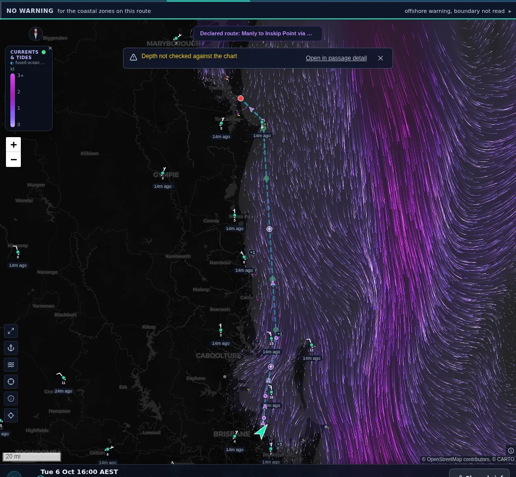
Where the current runs against the wind and swell, the Bureau of Meteorology warns of steep, dangerous seas, with waves that can be more than twice the total wave height. Shimbiri draws the currents and tidal streams on the chart on the same forecast clock as the wind, so you can see where the current runs along your route at the hour you will be there.
Facts from the CSIRO and Bureau pages, read 6 October 2026. Shimbiri’s currents layer fuses ocean current and tidal stream data and plays on the same forecast clock as the wind.
General information for Australian operators, current as of 6 October 2026. Rules change and recreational rules vary by state. Always confirm against the source(s) linked above (your AMSA, Australian Sailing or state maritime authority). This is not legal advice.